
Friday was marked by sunshine, comfortable conditions and no immediate threat of severe weather in the Chicago area.
But changes are approaching.
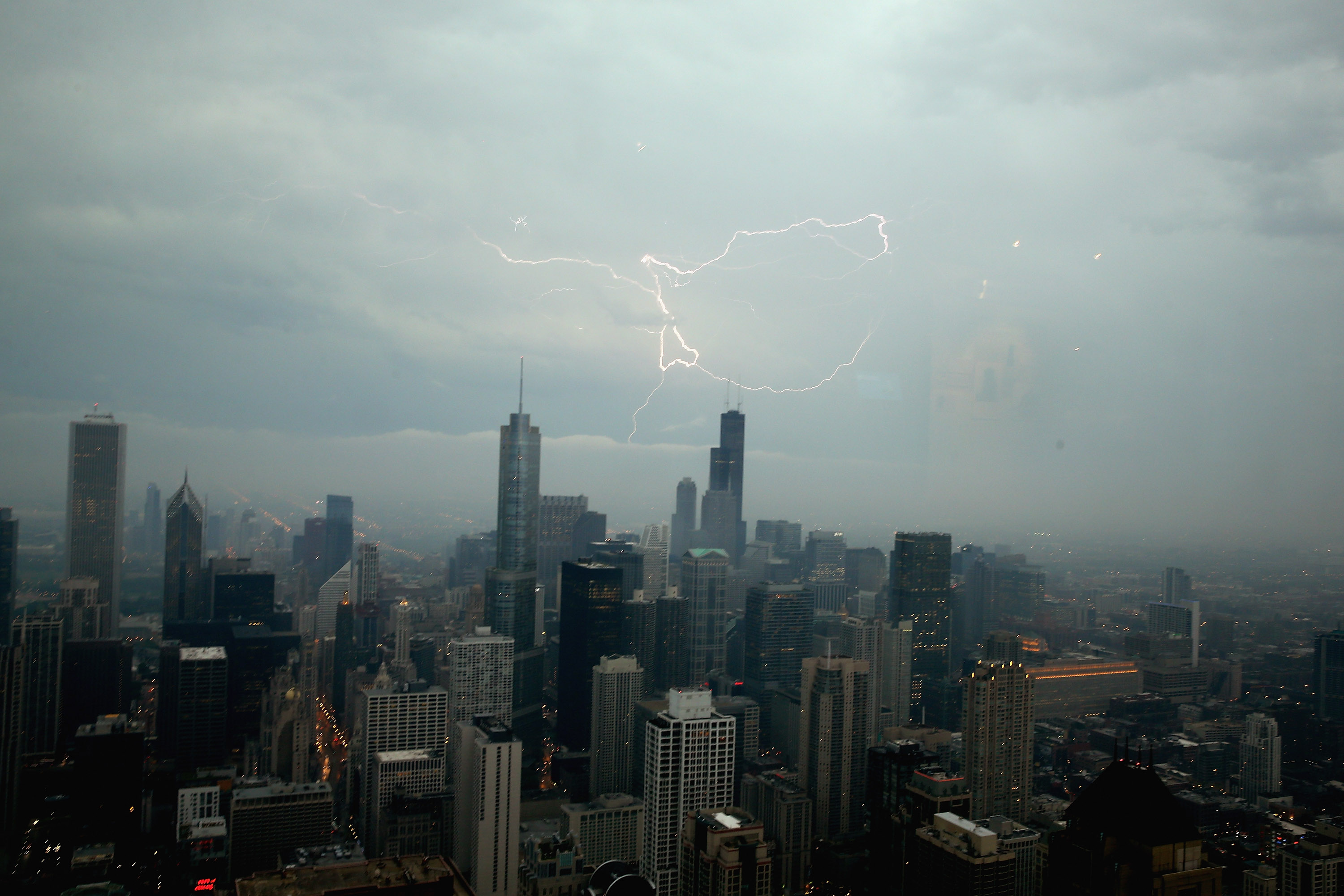
NBC 5 Storm Team Meteorologist Kevin Jeanes said strong thunderstorms were developing quickly over western Iowa Friday evening, and he’d be closely monitoring the situation to see how organized the storms become.
For the Chicago area, thunderstorms are expected to arrive around 2 a.m. and last through roughly 5 or 6 a.m.
The National Weather Service said in a social media post a few storms could be strong-to-severe with a threat for localized damaging winds, particularly west of the Fox Valley.
Come Saturday, a few lingering showers may continue through 8 or 9 a.m., although the day looks mainly dry.
Jeanes said he can’t entirely rule out a couple of isolated thunderstorms late Saturday afternoon or evening.
Afterward, Sunday brings the possibility of a few additional storms around midday. Jeanes said that while it should remain dry through the daylight hours, a few additional thunderstorms in the afternoon can’t be ruled out.
Make sure to stay with the NBC 5 Storm Team for the latest updates and conditions – and to be prepared for whatever mother nature brings our way.
Looking ahead to Monday, a slight chance of rain arrives early in the day, with a greater area of rain and thunderstorms expected to develop later on. Higher humidity could help boost the potential for stronger thunderstorms in the evening.
Warm temperatures are on tap for the weekend, with readings in the mid-80s on Saturday followed by slightly higher temperatures on Sunday and an increase in humidity.
The humidity peaks Monday into Tuesday, with dew point temperatures nearing 70 degrees and causing muggy conditions. If precipitation holds off, temperatures could reach close to 90 degrees.
However, if some rain develops in the late morning or early afternoon on Monday, temperatures may stay a little lower – which would limit the risk of severe weather in the evening.
Some rain may linger through the first half of the day Tuesday before drier and cooler conditions return as temperatures dip back into the 60s on Wednesday and Thursday.