Saturday, April 25, 2026
72 F
Illinois
More

    Latest Posts

    Chicago area faces threat of severe weather Monday – NBC Chicago


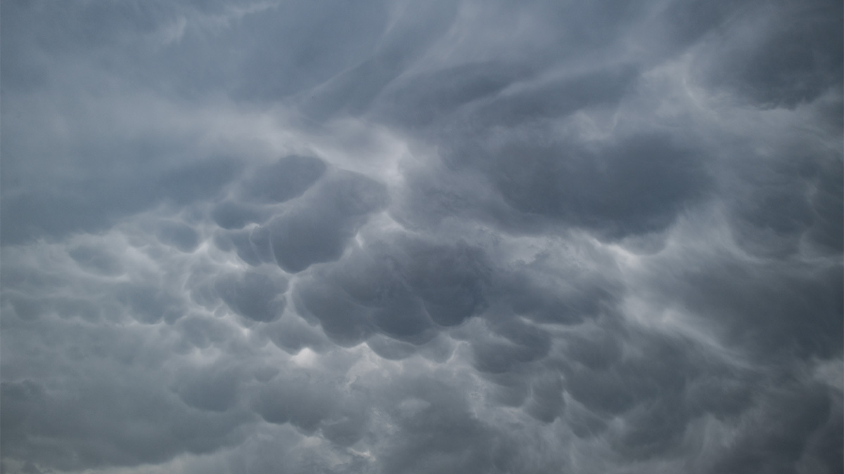
    Northern Illinois may be affected by strong to severe thunderstorms Monday afternoon and evening, bringing the possibility of all hazards, though meteorologists emphasize the tornado risk is highest elsewhere.

    The region sits on the northern edge of the severe weather risk, while evolving supercells capable of producing strong tornadoes are possible in central and southern Illinois and southeastern Iowa, according to NOAA’s Storm Prediction Center.

    According to the SPC, most of the Chicago area is under an “enhanced” risk of severe weather on Monday, which ranks as level three of five. Other portions of the region, including parts of Cook, Lake and McHenry counties, along with areas of northwest Indiana, are at a “slight” risk, which is level two of five.

    For the Chicago area specifically, one forecast model suggests morning storms could continue into the early afternoon, potentially limiting the development of strong storms and shifting the severe risk farther south and east.

    If those morning storms exit quickly, northern Illinois could become warmer and destabilize, increasing the potential for stronger storms later in the day.

    The greatest risks are damaging straight-line winds, large hail and potential tornado activity.

    Heavy rain and localized flooding are also possible, as rounds of storms could lead to “swaths of rainfall,” according to the NWS. Meteorologists are particularly concerned about rainfall along the Illinois/Wisconsin state line, which could cause levels of the Rock, Fox and Des Plaines rivers to rise again.

    While the greatest risk-zone for tornadoes is further south, meteorologists will be keeping a close eye on conditions in the Chicago area, as the severe risk will be shaped largely by events earlier in the day.

    The National Weather Service, in a post on X, stated “now is the time to prepare,” though noted the location of the highest threat is uncertain, as the storm severity depends on how conditions evolve.

    After Monday, relief arrives.

    It appears the stormy pattern will break for the last few days of April, with cooler and drier weather expected to close out the month.


    Source link

    Latest Posts

    Don't Miss

    [tdn_block_newsletter_subscribe title_text="Stay in touch" description="VG8gYmUgdXBkYXRlZCB3aXRoIGFsbCB0aGUgbGF0ZXN0IG5ld3MsIG9mZmVycyBhbmQgc3BlY2lhbCBhbm5vdW5jZW1lbnRzLg==" input_placeholder="Email address" tds_newsletter2-image="5" tds_newsletter2-image_bg_color="#c3ecff" tds_newsletter3-input_bar_display="row" tds_newsletter4-image="6" tds_newsletter4-image_bg_color="#fffbcf" tds_newsletter4-btn_bg_color="#f3b700" tds_newsletter4-check_accent="#f3b700" tds_newsletter5-tdicon="tdc-font-fa tdc-font-fa-envelope-o" tds_newsletter5-btn_bg_color="#000000" tds_newsletter5-btn_bg_color_hover="#4db2ec" tds_newsletter5-check_accent="#000000" tds_newsletter6-input_bar_display="row" tds_newsletter6-btn_bg_color="#da1414" tds_newsletter6-check_accent="#da1414" tds_newsletter7-image="7" tds_newsletter7-btn_bg_color="#1c69ad" tds_newsletter7-check_accent="#1c69ad" tds_newsletter7-f_title_font_size="20" tds_newsletter7-f_title_font_line_height="28px" tds_newsletter8-input_bar_display="row" tds_newsletter8-btn_bg_color="#00649e" tds_newsletter8-btn_bg_color_hover="#21709e" tds_newsletter8-check_accent="#00649e" embedded_form_code="JTNDIS0tJTIwQmVnaW4lMjBNYWlsQ2hpbXAlMjBTaWdudXAlMjBGb3JtJTIwLS0lM0UlMEElMEElM0Nmb3JtJTIwYWN0aW9uJTNEJTIyaHR0cHMlM0ElMkYlMkZ0YWdkaXYudXMxNi5saXN0LW1hbmFnZS5jb20lMkZzdWJzY3JpYmUlMkZwb3N0JTNGdSUzRDZlYmQzMWU5NGNjYzVhZGRkYmZhZGFhNTUlMjZhbXAlM0JpZCUzRGVkODQwMzZmNGMlMjIlMjBtZXRob2QlM0QlMjJwb3N0JTIyJTIwaWQlM0QlMjJtYy1lbWJlZGRlZC1zdWJzY3JpYmUtZm9ybSUyMiUyMG5hbWUlM0QlMjJtYy1lbWJlZGRlZC1zdWJzY3JpYmUtZm9ybSUyMiUyMGNsYXNzJTNEJTIydmFsaWRhdGUlMjIlMjB0YXJnZXQlM0QlMjJfYmxhbmslMjIlMjBub3ZhbGlkYXRlJTNFJTNDJTJGZm9ybSUzRSUwQSUwQSUzQyEtLUVuZCUyMG1jX2VtYmVkX3NpZ251cC0tJTNF" descr_space="eyJhbGwiOiIxNSIsImxhbmRzY2FwZSI6IjE1In0=" tds_newsletter="tds_newsletter3" tds_newsletter3-all_border_width="0" btn_text="Sign up" tds_newsletter3-btn_bg_color="#e73d8f" tds_newsletter3-btn_bg_color_hover="#000000" tds_newsletter3-btn_border_size="0" tdc_css="eyJhbGwiOnsibWFyZ2luLWJvdHRvbSI6IjAiLCJiYWNrZ3JvdW5kLWNvbG9yIjoiI2E3ZTBlNSIsImRpc3BsYXkiOiIifSwicG9ydHJhaXQiOnsiZGlzcGxheSI6IiJ9LCJwb3J0cmFpdF9tYXhfd2lkdGgiOjEwMTgsInBvcnRyYWl0X21pbl93aWR0aCI6NzY4fQ==" tds_newsletter3-input_border_size="0" tds_newsletter3-f_title_font_family="445" tds_newsletter3-f_title_font_transform="uppercase" tds_newsletter3-f_descr_font_family="394" tds_newsletter3-f_descr_font_size="eyJhbGwiOiIxMiIsInBvcnRyYWl0IjoiMTEifQ==" tds_newsletter3-f_descr_font_line_height="eyJhbGwiOiIxLjYiLCJwb3J0cmFpdCI6IjEuNCJ9" tds_newsletter3-title_color="#000000" tds_newsletter3-description_color="#000000" tds_newsletter3-f_title_font_weight="600" tds_newsletter3-f_title_font_size="eyJhbGwiOiIyMCIsImxhbmRzY2FwZSI6IjE4IiwicG9ydHJhaXQiOiIxNiJ9" tds_newsletter3-f_input_font_family="394" tds_newsletter3-f_btn_font_family="" tds_newsletter3-f_btn_font_transform="uppercase" tds_newsletter3-f_title_font_line_height="1" title_space="eyJsYW5kc2NhcGUiOiIxMCJ9" content_align_horizontal="content-horiz-center"]